Jasper Gorge in Gregory National Park Australia | Gregory National Park from Darwin to Broome Australia | Gregory National Park on the Victoria Highway in Northern Territory

Judbarra / Gregory National Park from the Victoria Highway Northern Territory

Gregory national park©
About Jasper Gorge in Judbarra / Gregory National Park in Northern Territory Australia
~ Home ~ Site destination links ~ Kimberley Map ~ Maps©
About Judbarra / Gregory National Park in Northern Territory Australia

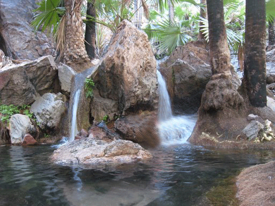
Jasper Gorge
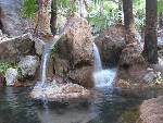
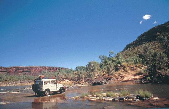
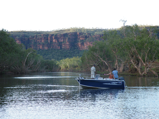
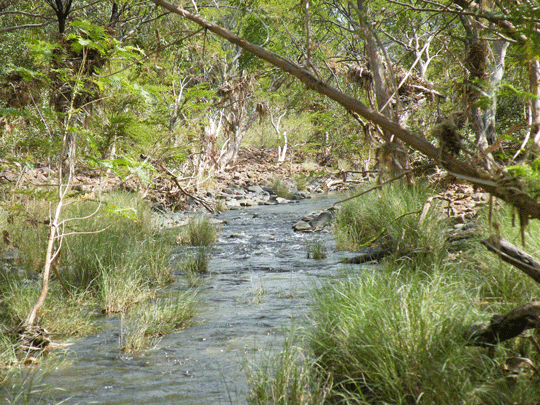
Jasper Gorge with its permanent waterhole is located 48 kilometres, 30 miles, southwest of Timber Creek, just south of the Aboriginal Land Trust area. Gregory National Park is a remote area with rough terrain and features tropical and semi-arid plant life, spectacular range and gorge scenery. It is a very exciting park to explore if you have a 4WD but if not you can still see Limestone Gorge.


Gregory National Park
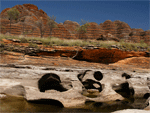
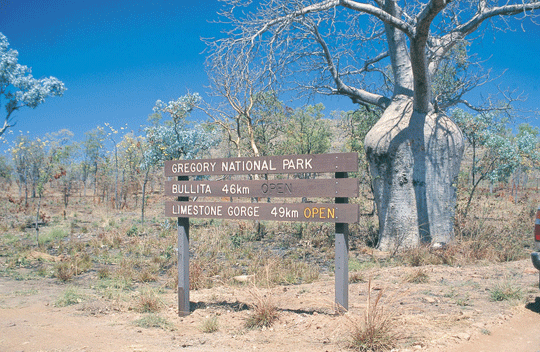
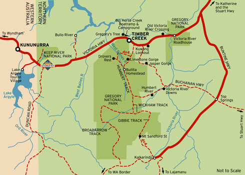
This park covers an area of about 13,000km sq and features spectacular gorge scenery, rare wildlife species, and significant traces of Aboriginal culture, European exploration and pastoral history. It is divided into 2 sections – the Victoria river sector in the east and the Gregory sector in the west. The Victoria river sector is near the Victoria river crossing and winds through 250 meter high tablelands, creating dramatic red cliffs. The large Gregory sector lies just outside Timber Creek. In the Gregory sector, Limestone Gorge provides a superb photographic opportunities. Also of interest is the old cattle property outstation, Bullita Homestead, with its traditional timber stockyards. Facilities at both Bullita and Limestone gorge camping areas include BBQ’s, picnic tables and pit toilets (note: the camp ground at Limestones Gorge is currently closed). Those with a 4WD will love exploring the network or 4x4 tracks. For more information, contact the Parks and Wildlife office at Timber Creek on (08)8975 0888. No pets allowed in the park.

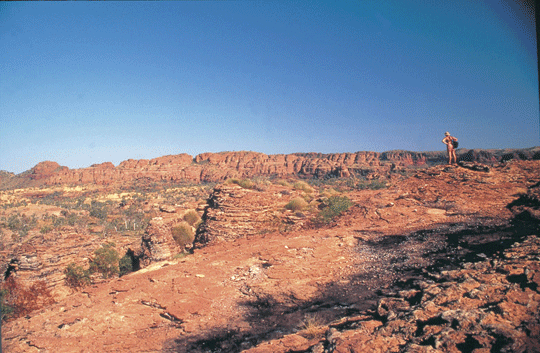
Judbarra / Gregory National Park covers an area of around 13,000 square km in the transition zone between tropical and semi-arid regions of the Northern Territory. The Park features spectacular range and gorge scenery and significant traces of Aboriginal culture, European exploration and pastoral history.

Where is Gregory National Park located
Gregory National Park starts some 200 klm west of Katherine in Northern Territory. There are two sections to the Gregory National Park. The Bullita Sector lies to the west of the Wanimiyn and Ngaliwurru/Nungali Aboriginal Land Trusts. The Victoria River Sector lies to the east of the same Trust area. Located in the south of the Bullita section, domite blocks and huge cliffs create the stunning Limestone Gorge - also good for fishing.


How to Get There
The Park may be reached via the Victoria Highway from either Katherine, Kununurra or the unsealed Buntine Highway. Judbarra / Gregory National Park can also be reached via the unsealed Buchanan Highway as well.

When to Visit
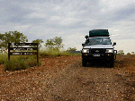
A number of 4WD tracks have been established within the Park for visitors who have the required safety equipment. Other roads within the Park are accessible by 2WD vehicles, however towing caravans or trailers over these tracks is not recommended. All roads, including the Victoria Highway may become impassable during the wet season.

What to See and Do
Boating, canoeing, bushwalking, and Aboriginal Art appreciation.
•Recreational Activities
•Plants & Animals
•Ranger Guided Activities

Visitor Facilities
Fuel, provisions, public telephones and accommodation are available at Timber Creek and the Victoria River Homestead. Police, banking facilities, vehicle repairs, boat hire and emergency medical care are available at Timber Creek.

Drinking water is available at Timber Creek and the Victoria River Homestead. Water obtained from rivers and billabongs should be boiled before drinking.

A number of tour operators operate within the Park, for further information regarding these tours, contact your nearest Tourist Information Centre.

Recreational Activities
Features and facilities of the Park include:
•4 x 4 Driving

•Accommodation
Gregory National Park only offers camping facilities which range from toilets and wood BBQ facilities to 4WD bush camps. (These have no toilet facilities) Commercial accommodation is available at Timber Creek, Top Springs and Kalkaridngi which are not located within the park.

•Boat Ramp
A boat ramp is located at Big Horse Creek west of Timber Creek. Changing tides, hidden snags and rocks make this section of the Victoria River potentially hazardous. A 2WD boat ramp also located at the Victoria River Gorge access in the Victoria Sector of the park.

•Boat Tours

•Camping Permitted
A number of camping areas have been established throughout the Park, incorporating barbecue areas, picnic tables and pit toilets. A nominal camping fee applies.

•Caravan Permitted
Caravans accessible only off the Victoria Highway. Not recommended to be taken into interior of Gregory National Park due to the rough terrain.

•Fishing

•Picnic Table

•Walking Tracks
Marked walking tracks have been developed within the Park. Before embarking on an extended bushwalk, visitors must first obtain a permit from a Ranger station.

Plants and Animals
The rivers, creeks and billabongs throughout the area are inhabited by both Freshwater and Saltwater (Estuarine) Crocodiles. The Saltwater Crocodile is potentially dangerous to humans. For your safety, do not swim in, or allow children to play near the water's edge.

Victoria River Crossing©
 
About Keep River National Park in Northern Territory Australia

Keep River National Park

Where is Keep River National Park located
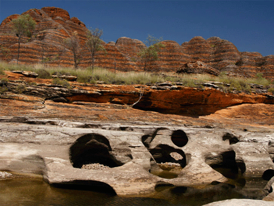
Located 468 km west of Katherine along the Northern Territory/Western Australia border, Keep River National Park is noted for its striking landforms.

How to Get to Keep River National Park
The Keep River National Park entrance is 3 km east of the NT/WA border. Formed gravel roads suitable for 2WD vehicles lead to the main attractions. During the wet season roads may be closed due to flooding. All vehicles are restricted to formed roads only.

When to Visit
The most comfortable months to visit the Park are from May through to the end of August, when temperatures range from 35 degrees Celsius max down to 10 degrees Celsius min.

What to See and Do
Visitors to the Park are provided with excellent opportunities for bushwalking, photography and the chance to learn about geological events that have shaped this landscape. Past evidence of volcanic activity, massive marine deposits and glaciation are visible in the rocks and landforms of this region.
•Recreational Activities
•Scenic and Cultural Features
•Plants & Animals
•Ranger Guided Activities

Visitor Facilities
Two camping areas have been provided: Gurrandalng, located 18km from the Park entrance and Jarnem, located 31km from the Park entrance. Camping facilities include tables, barbecues and pit toilets. Drinking water is available at two sites within the Park. Generators are permitted in the park at the Gurrandalng campground only, but must be turned off by 8:30pm.

Please Remember
Bushwalkers planning long walks or camping overnight outside the formal camping areas MUST NOTIFY a Ranger before setting off. Special conditions for overnight hikers involves getting a permit which can take up to a week or more to process so you need to be pre-organised and contact the Rangers for a copy of the permit and the other information you need to provide Rangers with. NO self guiding pamphlets are available for any of the walking tracks here. There is interpretive information at the walks and visitor centre. You will need drinking water, appropriate footwear and a hat. It is also advisable to have the topographical 1:100,000 scale map of the area. Generators are permitted in the park at the Gurrandalng campground only but must be turned off by 8:30pm. Pets are NOT allowed in the Park. Please collect firewood before arriving at your picnic or campsite.

Recreational Activities
•4 x 4 Driving •Camping Permitted •Caravan Permitted •Picnic Tables •Walking Tracks From the camping areas, visitors can explore the rugged and dissected terrain of sandstone formations. Longer walking tracks are located at the campgrounds and other localities. Thousands of years of erosion by the Keep River has formed the shallow sandstone Keep River Gorge (Jinumum Walk). A short walk along the floor of the Gorge provides an opportunity to view an Aboriginal Art site.

Scenic and Cultural Features
The Park falls within the Aboriginal tribal area of the Mirriuwoong and Gadjerong Aboriginal People. The Jinumum walk and the Lang-gerrbi (Nigli Gap) walk provide the visitor with the chance to see some of the rock art characteristic of the area.

Plants and Animals
Short-eared Rock-wallabies, White-quilled Rock-pigeons and Sandstone Shrike-thrushes are among some of the more interesting inhabitants of this amazing landscape.

About Timber Creek in Northern Territory Australia

• It doesn't matter if you are passing on through on your way to the Kimberly region in the west or to Katherine in the east or want to stop over for a while, we would like to invite you to drop in to our Timber Creek Hotel and Circle F Caravan Park and Motel.

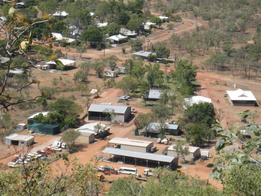
Timber Creek a small outback town with a small population of 556 is located on the Victoria Highway, 285 km west of Katherine and 193 km east of the border between the Northern Territory and Western Australia. See WA/NT border Quarantine Station.

It located on the Victoria Highway, which is the main route connecting Australia's Top End and the Kimberley region on the Savannahway. The location of Timber Creek township makes it a stopover location and base to explore the Gregory National Park. Also to get supplies.

Suggest for a stopover

Suggest for a stopover use Timber Creek Hotel and Circle F Caravan Park and Motel.
•Ice, Bait and Tackle
•Take Away Food
•BP Fuels
•Auto Gas/Kleenheat
•Airconditioned Fully Licensed Dining Room
•Airconditioned Public Bar
•EFTPOS Facilities
•Laundry Facilities
•Children's Playground
•for Park Guests, Shaded pool and spa area.

Another stopover is the Big Horse Creek Campground 7km west of Timber Creek, the Big Horse Creek is a popular base for anglers. The grounds offer toilets, fireplaces, limited drinking water and a cement boat ramp which can be used year round.

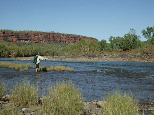
The Vic is a mecca for fishing and produces some of the Territory’s best and biggest Barramundi. “Barra” can be caught all year round but the best time is on a neap tide, between the months of March to late May-coinciding with the end of the monsoon season called the “Run-off”. It is VERY important to remember that Estuarine Crocodiles (saltie’s) inhabit this area, so please observe all safety precautions/signs around any water way in this region.

Gregory's Tree
Gregory’s tree is located 15km northwest of Timber Creek. This large boab tree stands at the campsite of the early explorer Augustus Charles Gregory’s north Australian expedition which was undertaken between October 1855 and July 1856. Inscribed in the tree by Gregory are the expedition dates. The Tree also has special significance to the local Ngaringman Aboriginal people and is registered as a sacred site.

Escarpment Lookout Walk
Located just west of the Victoria River Crossing, this short walk is steep in sections and provides panoramic views of the soaring red rocky escarpments of the Victoria River Valley.

Heritage Trail

The Heritage trail begins behind the council building and follows a series of historic sites and pioneer graves. This also provides a great spot for viewing wildlife.

Joe Creek Walk
A 90 minute walk of moderate grade, ascending to the base of the escarpment and to a breathtaking view. Aboriginal artwork can be viewed at a site along the walk, and a barbecue, picnic tables and toilet are provided. Day use only.

Kuwang Lookout
47km east of Timber Creek, the Kuwang lookout offers views towards the Stokes Range and houses an interpretive display featuring creation stories of the local Aboriginal people.

Policeman's Point Lookout
A short drive west of Timber Creek, this lookout offers views of the Victoria River winding through rugged hills and ranges. Policemen’s Point offers a good spot to fish from the bank or take in the majesty of the Victoria River.

Police Station Museum
The museum offers an insight into the history of the area, and provides artifacts and photographs on the area. The original ‘lock-up’ is also present, and helps highlight the hardships faced during the settlement of Outback Australia

Top Springs
This rugged road junction links the Buntine Highway and Buchanan Highway and houses the Top Springs Hotel / Roadhouse. Nearby springs provider a relaxing swimming spot. Accommodation, meals, fuel and basic groceries are available from the Roadhouse.

Buntine Highway
The Buntine Highway runs roughly parallel to the Victoria Highway, and offers an alternate route into Western Australia. The road links Dunmurra (NT) with Halls Creek (WA) and passes through Top Springs.

Victoria River Crossing
The Victoria River Crossing is 194km west of Katherine. The Stunning escarpment country provided the perfect backdrop for fishing and boat cruises, with Red Valley Gorge providing a shady and scenic rest area. The Roadhouse is close to the crossing, with camping and accommodation available. You can even take a helicopter flight over the incredible landscape.

Katherine Visitor Information Centre - just past the petrol station south of town - friendly staff we found and good for booking Victoria River activities.

Keep River National Park
Located 468 km west of Katherine along the Northern Territory/Western Australia border, Keep River National Park is noted for its striking landforms.

© source | courtesy of www.visitkatherine.com.au
© Source | courtesywww.parksandwildlife.nt.gov.au

©
Timber Creek©
Victoria River©
Victoria River©
Victoria River estuary©
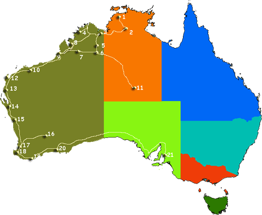
Map of Gibb River Road and Western Australia©
Approx. Distances from Perth Approx. Distances from Perth
01. Darwin -4040
03. Wyndham -3229
12. Karijini NP - 1400
13. Ningaloo + Coral Bay - Perth-1200Km
14. Monkey Mia - 856
...... Monkey Mia/Shell Beach 100Km Long
...... Monkey Mia/Shark Bay
15. Kalbarri -533
16. Kalgoorlie -596
17. Perth -0
18. Margaret River -277
19. Albany -409
20. Esperance -721
21. Adelaide - Perth 2712
..... Melbourne - Perth -3438
Approx. Distances from Broome (unless stated) Approx. Distances from Broome (unless stated)
1. Darwin -1867Km
2. Katherine -314Km
3. Kununurra -1042Km
3. Kununurra - Darwin -850Km
3. Kununurra - Lake Arglye -79Km
3. Kununurra - NT Border -57Km
3. Kununurra to El Questro -162Km
0. (Gibb River Road 710Km Long)
3. Wyndham -1057Km
4. Mitchell Plateau - Broome - 880km
5. Bungle Bungles - Kununurra -299km
.... (In Purnululu National Park)
.... (Highway to park 53km)

6. Halls Creek -683Km
6. Halls Creek - Kununurra-370Km
7. Fitzroy Crossing -395Km - 7/8 is Tunnel Creek - 380Km
8. Derby -221Km
9. Broome -Cape Leveque - 217Km nth of Broome
10. Port Hedland -597Km
11. Alice Springs to WA Border -740km (Via Tanami Hwy)
12. Exmouth - 1394Km
12. Karijini NP – Broome or nearest main destination -1024km Broome <>Tom Price
13. Ningaloo + Coral Bay - 1110Km Sth Broome
17. Perth - Broome - 2227

Approx. Distances from Perth Approx. Distances from Perth
01. Darwin -4040
03. Wyndham -3229
12. Karijini NP - 1400
13. Ningaloo + Coral Bay - Perth-1200Km
14. Monkey Mia - 856
...... Monkey Mia/Shell Beach 100Km Long
...... Monkey Mia/Shark Bay
15. Kalbarri -533
16. Kalgoorlie -596
17. Perth -0
18. Margaret River -277
19. Albany -409
20. Esperance -721
21. Adelaide - Perth 2712
..... Melbourne - Perth -3438
Please note locations and distances on the map above are approximate locations and measurment of distances. Any maps featured in this website are not to scale and should be used as a guide only.


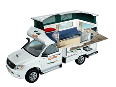
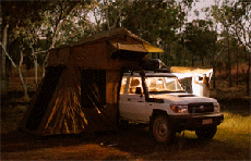
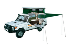
Instant detailed price search.

Search online for current best prices and a get a detailed quote. As a proudly Australian, family owned specialist travel agent business/company, we strive to exceed your expectations with our experienced service and friendly team of Rob and Marg whilst keeping prices as cheap as we can. We source only known reputable industry specialists some you may have never heard off but anchored as reputable suppliers across Australia. Due to the teams many 100's of thousdand of quotes and our many thousands of bookings over the last 20 years we know we can offer excellent value and above all perosnal service when booking your next Australia 4wd hire for a 4x4 camper or 4x4 car for your Australia RV holiday.