
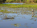
Motorcar Falls, Moline Rockhole and Boulder Creek in Kakadu |
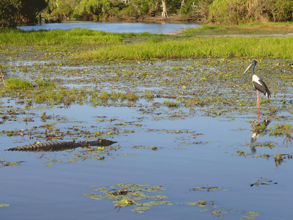
 � Motorcar Falls | NT Tourism Commission |
|
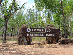
About Motorcar Falls (Motorcar Creek Walk), Moline Rockhole, Kurundie Falls and Boulder Creek in Kakadu National Park |
About Motorcar Falls (Motorcar Creek Walk), Moline Rockhole, Kurundie Falls and Boulder Creek in Kakadu AustraliaWhere Is Motorcar Creek Walk
Where Is Moline Rockhole
Where Is Kurundie Falls
Where Is Boulder Creek
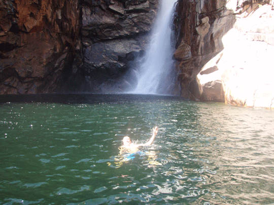
Where Is Yurmikmik Lookout source | courtesy of environment.gov.au/ Parks & Wildlife Commission of the Northern TerritoryHead Office - Goyder Centre 25 Chung Wah Tce Palmerston, NT 0830 Crocodile Safety InformationNorthern Australia is crocodile country. Therefore it is important to put awareness of crocodiles and safety at the top of your priority list when living in, working in or simply visiting crocodile habitat. Living with crocodiles is not difficult so long as you bear the following points in mind.� Always be aware that crocodiles may be present anywhere that there is water.� Unless there is clear signage that it is safe to swim, assume that crocodiles may be present. � Warning signs are there for your benefit! Ignoring them is foolish. � Always check with local authorities and rangers whether an area is likely to contain crocodiles. � If in doubt, always swim in designated swimming areas only. � If there's no sign, don't go swimming. � A spotlight or LED head-torch is strongly recommended at night so that any eyeshines can be seen, but a lack of eyeshines does not mean that it's safe to swim - crocodiles may be underwater.� We suggest you also visit a website called http://www.nt.gov.au/becrocwiseKakadu General Information There are many interesting places to discover in the area, but some things to remember too: � Saltwater crocodiles inhabit the South Alligator River and are extremely dangerous. Do not risk your life, keep away from the waters edge. � Freshwater crocodiles inhabit the area. Do not approach or interfere with them. � Do not jump off rocks or cliffs as there are unseen dangers and accidents have resulted in death. � Jim Jim Plunge Pool can be hazardous as the shallow water suddenly becomes deep. � Use the toilets provided. � Observe and enjoy the native animals, but do not disturb or feed them. Fishing is prohibited. � Use fuel stoves in preference to open fires. � If lighting open fires, collect firewood along the access road into Gunlom and use it sparingly. Use the fireplaces provided, attend fires at all times and extinguish them before you leave. � Use the recycling facilities supplied and place all other rubbish in the bins. Remember, cigarette butts, orange peel and tissues are rubbish too. � Sunscreen and insect repellent pollute waterways. Wear a long-sleeved shirt and hat as alternative protection. � The mornings and evenings are the best times to walk and observe wildlife. For your own comfort and safety please keep to the marked tracks, wear a hat and sturdy shoes, and carry plenty of drinking water.Kakadu National Park - Seasons But Australia's Kakadu sees seasons of varied extremes -- so varied, in fact, that the park's longtime aboriginal inhabitants have divided the year into six distinct seasons. � Kakadu Seasons - Gunumeleng Pre-Monsoon Storm Season - Gunumeleng, from mid-October to late December, may in fact last from a few weeks to several months. � Kakadu Seasons - Gudjewg - Monsoon Season - Gudjewg, from January to March, can be described as the 'true' wet season. � Kakadu Seasons - Banggereng - Knock 'em down storm Season - Banggerreng, in April, is the season when the rain clouds have dispersed and clear skies prevail. � Kakadu Seasons - Yegge - Cooler but still humid Season - Yegge, from May to mid-June, is relatively cool with low humidity. � Kakadu Seasons - Wurrgeng - Cold Weather Season - Wurrgeng, from mid-June to mid-August, is the 'cold weather' time; humidity is low, daytime temperatures are around 30�C and night-time temperatures are around 17�C. � Kakadu Seasons - Gurrung - Hot Dry Weather - Gurrung, from mid-August to mid-October, is hot and dry.Seasons The dry season which is approximatley which is classed generally as May - October each year.Though in current year the wet has not set in till late December or January and then finishes mid April.Access To Jim Jim Gorge The dry season which is approximatley which is classed generally as late June - October/November each year. We recommend you contact the offical Bowali Vistors Centre for more information.Kakadu National Park - Swimming Are there certain times of the year that I can�t swim? The seasonality of waterholes across the Northern Territory depend on the amount of rain throughout the year. NT Parks and Wildlife monitor water levels and erect signs advising visitors when it is safe to swim. Always obey sign posts. . How can you identify if a water-hole is safe to swim in? Salt and freshwater crocodiles are found in most Top End billabongs and rivers, and are occasionally seen on remote beaches. The accessible rivers and billabongs are generally sign-posted if saltwater crocodiles are known to inhabit the area, but if you are not sure, don�t swim. Swim only where recommended and always observe and read the crocodile warning signs. Aren�t swimming spots hard to get to or only acesible as part of a tour? All the swimming spots in Darwin, Litchfield National Park, Katherine, Mataranka and the MacDonnell Ranges are accessible by self-drive. A few locations are only accessible by four wheel-drive, such as Butterfly Gorge Nature Park and Tjaynera Falls in Litchfield National Park. Tour operators with swimming options include Adventure Tours Australia, Australian Pacific Touring, Connections Safaris, Odyssey Tours and Safaris and many more'. Resources
Links �
�
source | courtesy of kakadunationalparkaustralia.com |
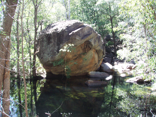 � Motorcar Falls | Boulder Creek area | NT Tourism Commission |
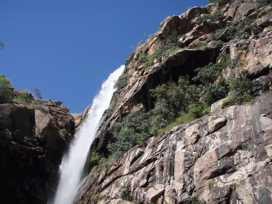
� Motorcar Falls | NT Tourism Commission |
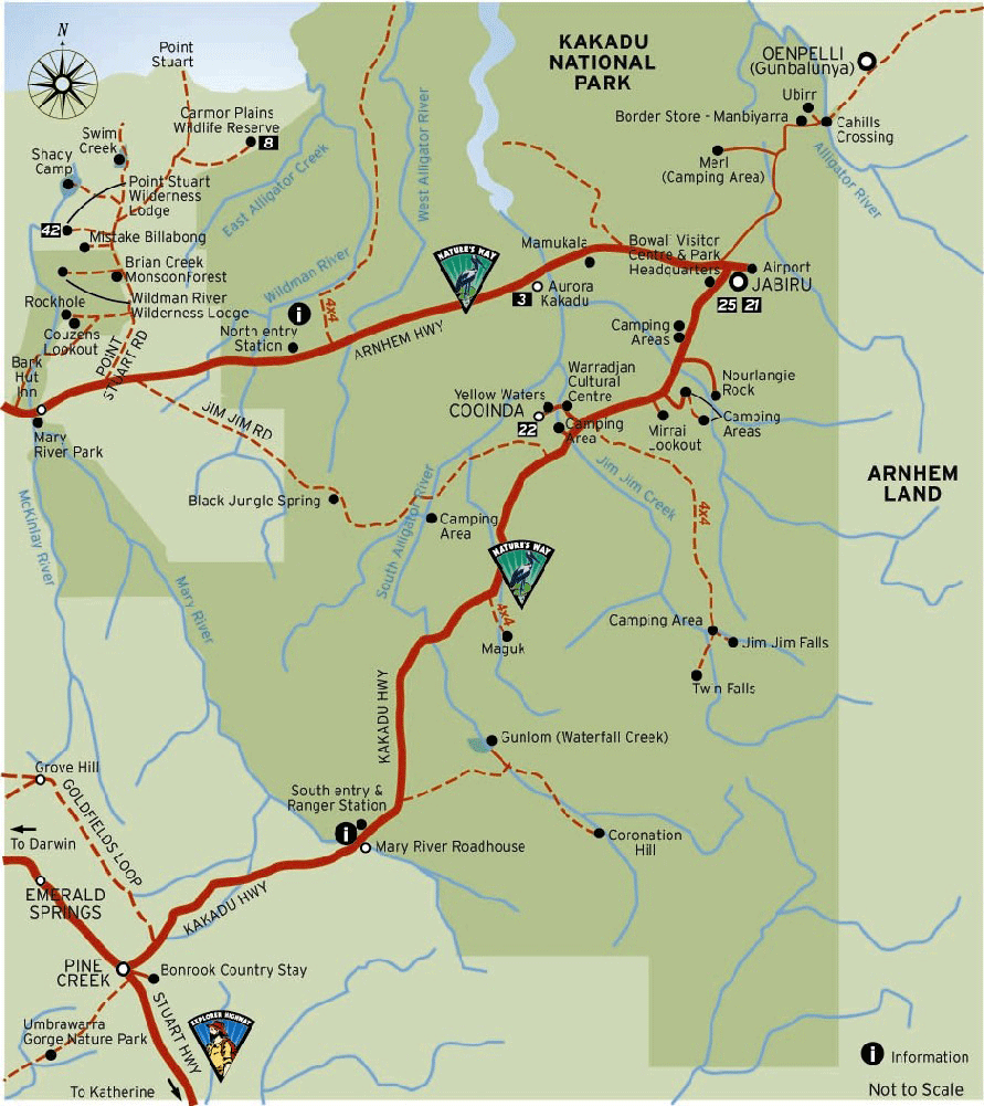 � NT Tourism Commission - map of Kakadu National Park Australia |

Instant detailed price search.


Search online for current best prices and a get a detailed quote. As a proudly Australian, family owned specialist travel agent business/company, we strive to exceed your expectations with our experienced service and friendly team of Rob and Marg whilst keeping prices as cheap as we can. We source only known reputable industry specialists some you may have never heard off but anchored as reputable suppliers across Australia. Due to the teams many 100's of thousdand of quotes and our many thousands of bookings over the last 20 years we know we can offer excellent value and above all perosnal service when booking your next Australia 4wd hire for a 4x4 camper or 4x4 car for your Australia RV holiday.
-
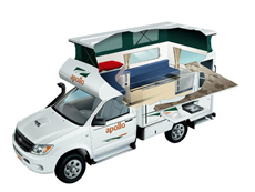
Apollo 4wd Adventure Camper rental
2 Berth - The compact Adventure Camper is perfect for those interested in a real outback adventure. Far roomier than similar vehicles, this 4WD campervan is ideal for thrill seeking couples. The extra fuel capacity means you can travel for longer without having to stop and the indoor and outdoor cooking facilities allows you to enjoy a dinner under the stars or in the cosy camper.
� Apollo 4wd Adventure rental details -
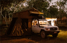
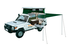
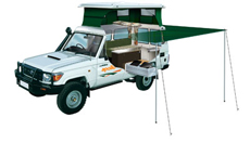
Britz LC Safari camper rental
Our unique Safari LC 4WD Camper sleeps 2 on the double rooftop bed and 3 more in the side annexe is perfect for off-road family adventures.Wonderful for exploring the great Australian Outback with a four wheel drive self drive hire. Available from Perth, Darwin, Broome and Alice Springs (return or oneway) and seasonal April till October each year so book early.
� 4wd Outback camper rental Australia details -
Apollo 4wd Trailfinder camper rental
Find your own trail with this pop-top 4WD Camper. A Trailfinder Camper is ideal for adventurous couples with superior handling in rough terrain. Featuring a large slide-out kitchen and pop top roof.
� 4wd Trailfinder camper rental Australia details
-
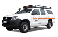
Australia 4x4 wagon offroad hire
Choose a Australian 4 wheel drive car hire return or oneway rentals from branches in Adelaide, Alice Springs, Brisbane, Broome, Cairns, Darwin, Melbourne, Perth and Sydney depots. � Our range consists Amarok or Toyota Landcruiser 76 series Workmate Wagon or similar options. Look at our current Australia 4wd hire specials.
�See prices and get a quote for Australia 4wd car hire here
-
Australia 4x4 camper offroad hire
Australia 4 Wheel Drive Hire.com - Looking for a Northern Territory or Western Australia offroad routes Self drive Australia 4wd and highway routes � here are some self drive itineraries � 4WD Broome to Darwin, Margaret River Wine Experience � Southern Wonders Wine Forest Experience selfdrive Western Australia
� See prices and instant quotes 4wd Camper rentals in Australia
-
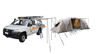
Australia 4x4 and tent offroad hire
5 Seat 4WD Campers or 4WD Car with tents packages for camping hire called the Safari Camper sleeps up to 5 Adults with camping gear. Excellent setup camp early eve and enjoy the great outdoor and have your dinner at a 5 million star spot.
� See prices and get a quote for Australia 4wd car hire here