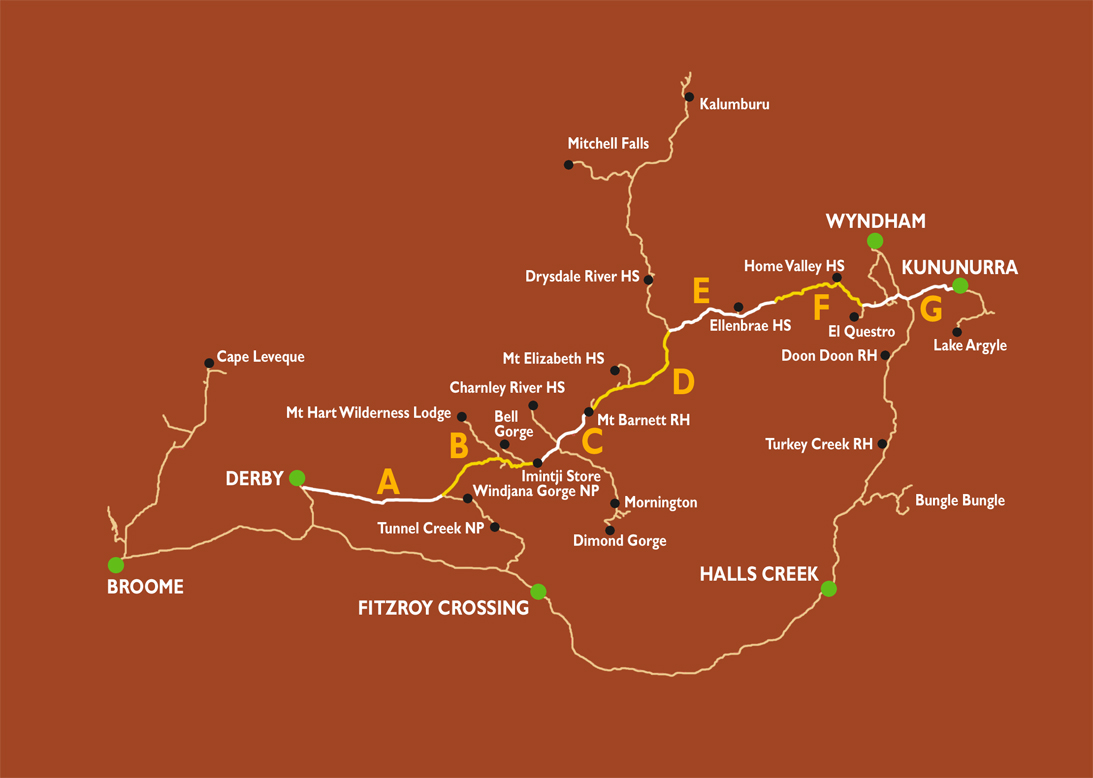
About Kununurra in the Kimberley in Western Australia
Kununurra to Western Australia and Northern Territory border
is 37 kilometres (23 miles)
Kununurra is a town in far northern Western Australia
located at the eastern extremity of the Kimberley Region approximately
37 kilometres (23 mi) from the border with the Northern Territory.
Kununurra was initiated to service the Ord River Irrigation
scheme. Kununurra is the largest town in Western Australia north
of Broome, with the closest town being Wyndham, 100 kilometres
(62 mi) away. Kununurra is 3,040 kilometres (1,889 mi) from
Perth via the Great Northern Highway. The town is situated in
among the scenic hills and ranges of the far north-east Kimberley
Region, having an abundance of fresh water, conserved by the
Ord River Diversion dam and the main Ord River Dam. The tropical
agriculture crops grown in the Ord River Irrigation Area (ORIA)
have changed over the years. Tourism and mining have also become
important to the local economy.
Things to do around Kununurra
City of Ruins (Lost City)
These natural sandstone formations resemble an ancient city,
and provide an interesting walk. Take the signpost to the right
from Weaber Plain Road.
Ivanhoe Crossing
Ivanhoe fishing - The crossing is a concrete causeway over the
Ord River, north of Kununurra, originally part of the main road
through to Wyndham. Since the start of the Ord irrigation project
in the 1960's, the river now flows all year round, making the
crossing impassable during the "Wet season" when the river level
is higher. It is a popular spot for barramundi fishing and picnicking.
Swimming and standing on the crossing to fish is not recommended
due to the presence of salt water crocodiles.
Kelly's Knob Lookout
Great place to watch a glorious sunset and finish a day of looking
around the town. Sealed road to the top with a short walk to
look over the town of Kununurra, the Ord irrigation area, Lake
Kununurra and the Sleeping Buddha.
Diversion Dam
Designed to divert and regulate the flow of water from the Ord
River into the Ord Irrigation area. The dam consists of 20 radial
gates mounted within a concrete framework and spillway structure.
The water is gravity fed into channels to service the area to
the north of the town and is pumped into the Packsaddle Plains
area to the south. The dam also forms part of the Victoria Highway.
Lions Park Picnic
Area Take a drive out over the Diversion Dam and turn right
after Packsaddle Road, into the track behind the Information
Bay. Here you will find a great spot to take photos of the dam,
have a picnic or launch your boat. No swimming due to the presence
of saltwater crocodiles.
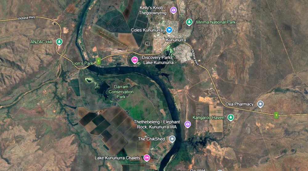
Lake Kununurra
The lake was formed after the completion of the Diversion Dam.
It harbours a large variety of flora and fauna, contains wetland
areas and provides a water frontage to the town, many small
farms and tourist developments. It is also used extensively
for sailing, rowing and skiing, supports several tour boat operations
and is the landing field for float planes.
Celebrity Tree Park
During Kununurra's short history, the Ord Irrigation scheme
has attracted world wide attention bringing a wide range of
celebrities through town. The park was opened in 1984 and celebrities
such as John Farnham, HRH Princess Anne, Rolf Harris and Harry
Butler have all planted trees here.
Lily Creek Lagoon
Lily Creek Lagoon filled after the completion of the Diversion
Dam. The old Darwin road once ran through the lagoon disappearing
at what now is the central boat ramp for the town. For anyone
interested in bird watching, there is a large variety of birds
to be seen around the water's edge.
Historical Society Walk
The walk trail was developed by the Kununurra Historical Society
(Inc) to provide an historical overview of the town and give
visitors an opportunity to view the local bird life. The booklet
describing the trail can be purchased from the Kununurra Tourist
Bureau.
Kununurra Historical Society
The Museum is situated in Coolibah Drive across from the Picture
Gardens complex. The museum is a must for anyone interested
in the area's colourful beginnings with many artifacts and photos
on display.
The Picture Gardens
Have a night out at Kununurra's open air movie theatre in Coolibah
Drive during the dry season. Drive in or walk in - it's up to
you. Enjoy a night under the stars reliving your old Drive-In
days or finding out what they were all about.
Elephant Rock/Sleeping Buddha
Sleepingbudah Large rock formation on the edge of town, officially
known as Carlton Ridge but nicknamed locally with the above
names. To look at it as Sleeping Buddha from the side, the best
view is from Celebrity Tree Park in town. Looking at it from
one end it resembles an elephant's head and this can be seen
from Packsaddle Road or by travelling on the upper Ord River
towards Lake Argyle.
Valentine Springs/Middle Springs/Black Rock Pool
During the wet season after heavy rains, these areas show off
their brilliant waterfalls making for excellent swimming and
picnic spots. Access is by 4WD, taking the turn off about 10km
out of Kununurra, on the highway to Wyndham. Caution if creeks
are flowing after rain. This road may be closed during the wet
season.
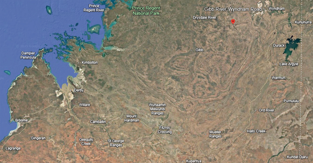
Kununurra Ord River
Lake Argyle
Planning a vacation to self drive to kununurra then 4x4 trek The Gribb River Road and into Broome. When you are visiting the north of Australia, Lake Argyle is your first stop in Western Australia after the Quarantine Check Point when travelling from the Northern Territory and the last of the Kimberley’s amazing attractions when leaving Western Australia. The closest town is Kununurra – one of our younger country towns in Australia and a service centre for the East Kimberley’s growing industries in tourism, agriculture and mining industries! Kununurra Agricultural Industry includes melons, mangoes and until recently, sugar cane.
Lake Argyle is situated at the end of one of the most scenic drives in Australia. The easiest way to visit Lake Argyle is to drive the sealed road from either the Northern Territory or the town of Kununurra.
Lake Argyle is Australia’s largest expanse of freshwater covering an area of more than 900 square kilometres at full supply level and up to 2000 square kilometres when in flood. Once a habitat that was subject to the cycles of the wet and dry seasons, now this massive expanse of permanent fresh water has allowed a thriving ecosystem to develop. The magnificent scenery and peaceful isolation make Lake Argyle a must see destination when visiting the Kimberley!
Stage One: Diversion Dam By 1958 the WA government was convinced of the viability of an irrigation scheme on the Ord. The Federal Government agreed to share the cost of stage one and this was completed in 1963 at a cost of $20 million. 1966 had allocated 31 farms. The irrigation project suffered initials setback, but is now extremely successful and grows a huge variety of produced.
Stage Two: The Ord Dam The second stage was the construction of the Ord River Dam to provide a major storage reservoir called Lake Argyle at a cost of $22 million. This was officially opened in 1972. As a part of stage 2 a further 200ha were allocated on the Packsaddle Plain and 5 farms were released in 1974.
Stage 3: The Hydro Power Station Aside from providing
a reliable source of power to the region, the project has had
a positive effect on tourism. It is the only commercial hydro
power station in W.A. Replacing fossil fuels previously used
to generate power. The hydro station harnesses a resource that
would otherwise go to waste, which is environmentally a far
better option. The power station was designed using 4 turbines
and two 15 mega-watt generators to produce more than 220gigawatt
hours of electricity per annum. At present the power station
provides power for the towns of Kununurra and Wyndham and to
the Argyle Diamond Mine.
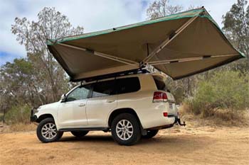
Kununurra accommodation- courtesy Jackie and Rob S
Argyle Diamonds
Argyle Diamonds is the largest diamond producing
mine in the world and in conjunction with a local Kununurra
tour operator offer ground tours of the mine on a fly in basis
only. Argyle Diamonds play a major role in the Kununurra community
with support and sponsorship of various East Kimberley events.
Argyle Diamonds Alongside the East Kimberley's wealth of natural
wonders is one of the state's most unique tourist attractions-
Rio Tinto's Argyle diamond mine. In support of the local tourism
industry, the Argyle diamond mine is open to visitors on guided
tours departing from Kununurra. A day trip to the mine will
give visitors a rare insight into the scope of a large mining
operation and the history of its relationship with Traditional
Owners.
Turkey Creek Roadhouse - Warmun
is on the Great Northern Highway, 200km south of Kununurra,
860km east of Broome and 160km north of Halls Creek.
Turkey
Creek Roadhouse to the Bungle Bungle Ranges 4x4 road
-
4wd Wagon hire -
 4wd camper family of 5
4wd camper hire for a family of May till October Broome and Darwin
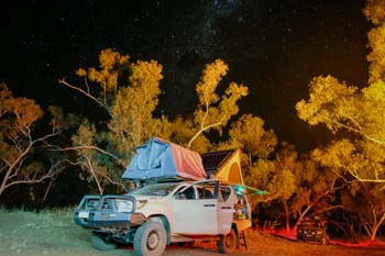
Darwin 4wd camper
-
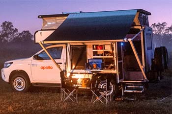 4wd Adventure Camper
Sleep inside more room better kitted out Adventure camper rental
4wd camper Darwin