|
The Kimberley - Broome to Darwin
|
||
 |
||
|
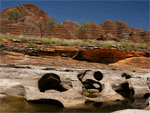
About the Kimberley
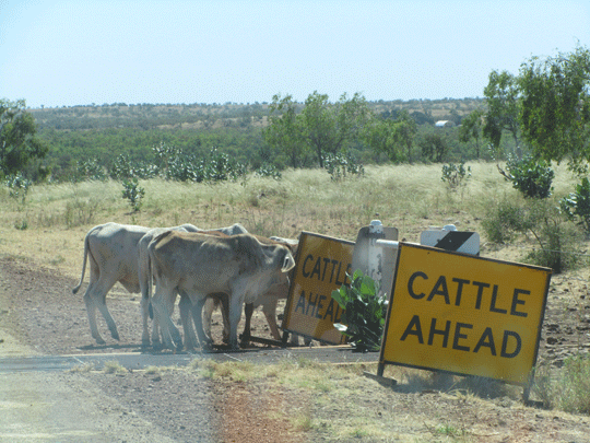
� The Kimberley in Australia is one of the last true wilderness areas on Earth, with rustic unique outback landscapes and landmarks billions of years in the making. Covering app 423,000 square kilometres in north Western Australia and with a population of less than 40,000 people, it�s here you�ll encounter some of the most extraordinary outback adventuresand folks in Australia. Discover ancient gorge country with hikes and trekking a must in planning your Kimberley vacation to enormous cattle stations, pristine coastline and sandy beaches, to one of the oldest cultures on the planet and the world�s only horizontal waterfalls. |
||
|
Western Australia and National Parks (WA) towns,
rivers, roads, crossings, stopovers and places of interest (WA) Mitchell Plateau Region Fairfields Leopold Downs Road Region Bungle Bungle Region El Questro Pilbara Region Australia's Coral Coast South Coast Four Wheel Hire - Darwin to Broome or Perth return
or continue on Campervan Hire or Motorhome Rentals - Darwin to
Broome or Perth return or continue on |
||
|
|
||
 |
||
|
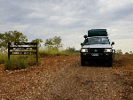
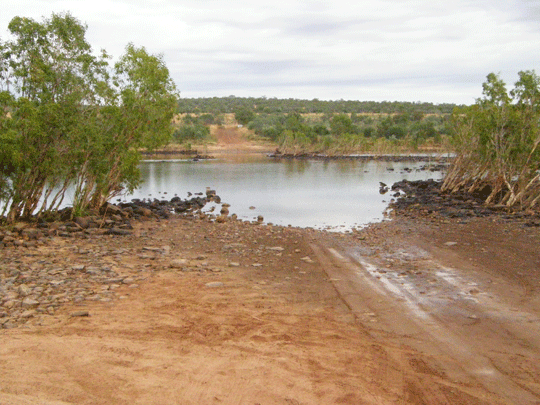
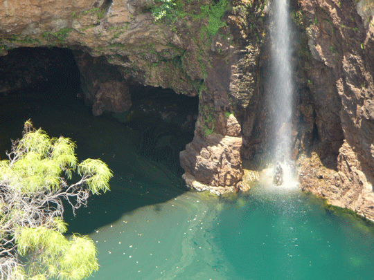
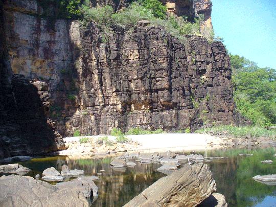
About the Gibb River Road |
||
|
Western Australia and National Parks (WA) towns,
rivers, roads, crossings, stopovers and places of interest (WA) Mitchell Plateau Region Four Wheel Hire - Darwin to Broome or Perth return
or continue on Campervan Hire or Motorhome Rentals - Darwin to
Broome or Perth return or continue on |
||
|
|
||
 |
||
|
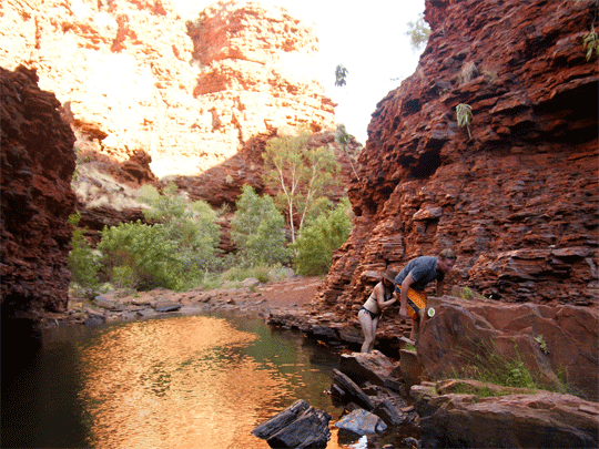
About Karijini National Park Australia
Karijini National Park protects many different wildlife habitats, landscapes, plants and animals of the Pilbara. Wildflowers vary with the seasons. In the cooler months the land is covered with yellow-flowering cassias and wattles, northern bluebells and purple mulla-mullas. After rain many plants bloom profusely. It is also home to a variety of birds, red kangaroos and euros, rock-wallabies, echidnas and several bat species. Geckos, goannas, dragons, legless lizards, pythons and other snakes are abundant. Huge termite mounds are a feature of the landscape and the rock piles of the rare pebble mound mouse may be found in spinifex country. |
||
|
Western Australia and National Parks (WA) towns,
rivers, roads, crossings, stopovers and places of interest (WA) Four Wheel Hire - Darwin to Broome or Perth return
or continue on Campervan Hire or Motorhome Rentals - Darwin to
Broome or Perth return or continue on
|
||
|
|
||
 |
||
|
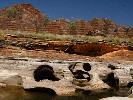
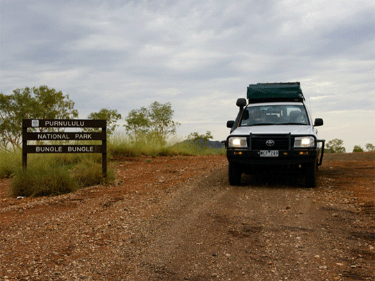
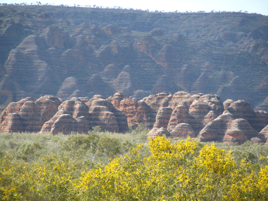
About Bungle Bungle Ranges |
||
|
Western Australia and National Parks (WA) towns,
rivers, roads, crossings, stopovers and places of interest (WA) Four Wheel Hire - Darwin to Broome or Perth return
or continue on Campervan Hire or Motorhome Rentals - Darwin to
Broome or Perth return or continue on |
||
|
|
||
 |
||
|
About Broome From its rough and tumble, romantic pearling history to the cosmopolitan character of Chinatown, to the turquoise waters, red sandstone cliffs and the endless expanse of white sand at Cable Beach....the colours and moods of Broome will capture your soul. You'll never want to leave. Pilbara Region Australia's Coral Coast South Coast Four Wheel Hire - Darwin to Broome or Perth return
or continue on Campervan Hire or Motorhome Rentals - Darwin to
Broome or Perth return or continue on |
||
|
|
||
 |
||
|
About Exmouth - The Coral Reef and Ningaloo The Ningaloo Marine Park stretches from Coral Bay round the North West Cape to Exmouth. For snorkellers and nature lovers, this is an irresistible opportunity. Australia's Coral Coast Four Wheel Hire - Darwin to Broome or Perth return
or continue on Campervan Hire or Motorhome Rentals - Darwin to
Broome or Perth return or continue on |
||
|
|
||
 |
||
|
About Perth and South West Coast |
||
|
South Coast Four Wheel Hire - Darwin to Broome or Perth return
or continue on Campervan Hire or Motorhome Rentals - Darwin to
Broome or Perth return or continue on |
||
|
|
||
 |
||
|
About Darwin Australia Darwin is located on the coast and is 253 from the Kakadu National Park entrance gates on the nothern entrance being the Arnhem Highway. From Darwin you can self drive down 332klm ton the Stuart Highway to Katherine and Katherine Gorge. Things to do in Darwin: From the East Point Reserve, to the Darwin Botanical Gardens. Walk along Nightcliff foreshore or Casuarina Beach you are never without something to do. We even have the open Deckchair Cinema a must for any visitor and nightlife that's easy to get to such as the Mitchell Street entertainment strip. Venture further out of Darwin and we come to the Outer Greater Darwin region some 20-45klm out and see the Territory Wildlife Park or the famous Jumping Crocodile Cruises on the Adelaide River. |
||
|
Darwin Four Wheel Hire - Darwin to Broome or Alice Springs
return or continue on Campervan Hire or Motorhome Rentals - Darwin to
Broome or Alice Springs return or continue on |
||
|
|
||
 |
||
|
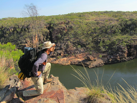
About Katherine Gorge Australia Nitmiluk National Park has two main points of visitor access. The Park's main entrance is located 30 km northeast of Katherine via a sealed road. Katherine is located 310 km south of Darwin along the Stuart Highway. � Leliyn Falls (Edith Falls) on the western side of the Park, is reached by turning off the Stuart Highway 42km north of Katherine then following a sealed road for a further 19km.� The most comfortable months to visit the Park are from May to September. |
||
|
Katherine Katherine to Kununurra Four Wheel Hire - Darwin to Katherine or Kununurra
return or continue on Campervan Hire or Motorhome Rentals - Darwin to
Katherine or Kununurra return or continue on |
||
 |
||
|
About Litchfield National Park Australia Why not 4WD tracks into some of the more remote parts of Litchfield National Park and surrounding region or even across the Darwin harbour to mandorah. Litchfield National Park is approximately 130km's southwest of Darwin near the town of Batchelor and covers around 1,500 sq km's. |
||
|
Litchfield Four Wheel Hire - Darwin to Litchfield Campervan Hire or Motorhome Rentals - Darwin to
Litchfield |
||
 |
||
|
About Kakadu National Park Australia
� Self drive to the Kakadu National Park from Darwin in a 4wd camper or family RV motorhome hire. Darwin is located on the coast and is 253 from the Kakadu National Park entrance gates on the nothern entrance being the Arnhem Highway. From Darwin you can self drive down 332klm ton the Stuart Highway to Katherine and Katherine Gorge. |
||
|
Kakadu Arnhem Highway Four Wheel Hire - Darwin to Kakadu Campervan Hire or Motorhome Rentals - Darwin to
Kakadu |
||
|
|
||
 |
||
|
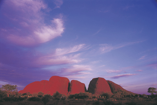
About Uluru Kata Tjuta National Park Australia
� Self drive to the Alice Springs then onto Uluru which was called Ayers Rock, 45klm away to Kata Tjuta once again known as The Olgas and 232klm (all approx) to Kings Canyon. There is the famous Mereenie Loop a 4wd road for our hire vehicles which comes into Glen Helen Gorge and the West MacDonnell Ranges and back to Alice Springs. |
||
|
Stuart Highway Tanami Road Four Wheel Hire - Darwin to Alice Springs or from
Alice Springs Campervan Hire or Motorhome Rentals - Darwin to
Alice Springs or from Alice Springs |
||
|
|
||
 |
||
|
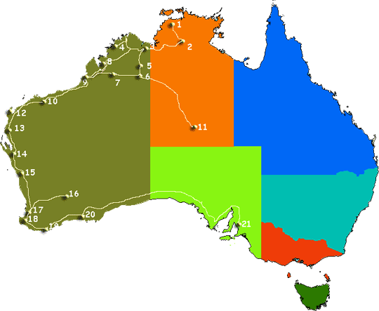
Approx. Distances from Perth Approx. Distances from Broome (unless stated) Approx. Distances from Perth Approx. Distances from Broome (unless stated) Please note locations and distances on the map above are approximate locations and measurment of distances. Any maps featured in this website are not to scale and should be used as a guide only. |
||
|
|
||
 |
||
|
|
||
|
Western Australia and National Parks (WA) towns,
rivers, roads, crossings, stopovers and places of interest (WA) Mitchell Plateau Region Fairfields Leopold Downs Road Region Bungle Bungle Region El Questro Pilbara Region Australia's Coral Coast South Coast
Northern Territory and National Parks (NT) rivers, roads, crossings, stopovers and places of interest (NT) Darwin Katherine Katherine to Kununurra Litchfield Kakadu Arnhem Highway Stuart Highway Tanami Road |

![]()
Instant detailed price search.


Search online for current best prices and a get a detailed quote. As a proudly Australian, family owned specialist travel agent business/company, we strive to exceed your expectations with our experienced service and friendly team of Rob and Marg whilst keeping prices as cheap as we can. We source only known reputable industry specialists some you may have never heard off but anchored as reputable suppliers across Australia. Due to the teams many 100's of thousdand of quotes and our many thousands of bookings over the last 20 years we know we can offer excellent value and above all perosnal service when booking your next Australia 4wd hire for a 4x4 camper or 4x4 car for your Australia RV holiday.
-
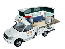
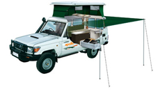
Apollo 4wd Adventure Camper rental
2 Berth - The compact Adventure Camper is perfect for those interested in a real outback adventure. Far roomier than similar vehicles, this 4WD campervan is ideal for thrill seeking couples. The extra fuel capacity means you can travel for longer without having to stop and the indoor and outdoor cooking facilities allows you to enjoy a dinner under the stars or in the cosy camper.
� 4wd Adventure rentals for outback travel -
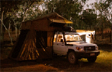
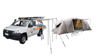
Britz LC Safari camper rental
Our unique Safari LC 4WD Camper sleeps 2 on the double rooftop bed and 3 more in the side annexe is perfect for off-road family adventures.Wonderful for exploring the great Australian Outback with a four wheel drive self drive hire. Available from Perth, Darwin, Broome and Alice Springs (return or oneway) and seasonal April till October each year so book early.
� 4wd Outback camper hire for offroad -
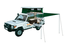
Apollo 4wd Trailfinder camper rental
Find your own trail with this pop-top 4WD Camper. A Trailfinder Camper is ideal for adventurous couples with superior handling in rough terrain. Featuring a large slide-out kitchen and pop top roof.
� 4wd Trailfinder camper rental Australia
-
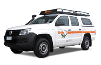
Australia 4x4 wagon offroad hire
Choose a Australian 4 wheel drive car hire return or oneway rentals from branches in Adelaide, Alice Springs, Brisbane, Broome, Cairns, Darwin, Melbourne, Perth and Sydney depots. Look at our current Australia 4wd hire specials.
� Australia 4wd car with roof rack and snorkel
-
Australia 4x4 camper offroad hire
Australia 4 Wheel Drive Hire.com - Northern Territory or Western Australia offroad routes Self drive Australia 4wd and highway routes � 4WD Broome to Darwin, Margaret River Wine Experience � Wine Forest Experience selfdrive.
� 4wd Camper hire for Gibb River Road
-
Australia 4x4 and tent offroad hire
5 Seat 4WD Campers or 4WD Car with tents packages for camping hire called the Safari Camper sleeps up to 5 Adults with camping gear. Camp early eve and enjoy the great outdoor and have your dinner at a 5 million star spot.
� See prices and get a quote for Australia 4wd car hire here